The role of the GeoMentor is to deliver workshops to schools, students, and teachers promoting the 5*S content as well as the Copernicus programme. Being a GeoMentor is a great opportunity as it allows you to promote the field you are in to the next generation and get the next cohort of students pursuing careers in Geomatics and Surveying.
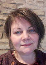
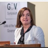
Here are the profiles of some of our GeoMentors:
Sarah Sherlock:

Sarah Sherlock joined the Irish Defence Forces, Devoy Barracks, Naas in 1996, as an Apprentice Carpenter & Joiner. Having completed her apprenticeship, she later went on to complete a BSc (Hons) in Geomatics at the Dublin Institute of Technology. She is a keen advocate of education and why we must not ever stop learning – ever, she has completed many courses and holds postgraduate qualifications in Urban and Building Conservation at UCD and Planning and Environmental Law at Kings Inns. Since leaving the Defence Forces, Sarah has worked within Murphy Geospatial, and she is currently a Geospatial Consultant within the company. Sarah became a Chartered Surveyor with the Society of Chartered Surveyors of Ireland in 2015, (being a member of the Irish Institution of Surveyors before that) and is the current Chair of the Geomatics Professional Group. She is passionate about education and standards – she is a member of the International Land Measurement Standards Setting Committee.
Eugen Niculae
:

Eugen completed undergraduate and postgraduate studies in Geodesy in Bucharest, Romania and then joined ISCE as an Engineering Surveyor in 1998. He then held roles in DMC Surveys in Kells and Korec Group in Dublin. Eugen joined Murphys Surveys in 2008 as a Senior Surveyor in their offices in London across a range of projects and technical and quality manager, training new members of staff. In 2017, Eugen became a lecturer in Technological University Dublin, where he is currently employed. Eugen became a Chartered Surveyor in 2008 and is the current Vice Chair of the Geomatics Professional Group.
Lorraine McNerney:

Lorraine is the General Manager (National Gesopatial ICT) at Ordnance Survey Ireland. She is a Qualified geo-surveyor, with a Bachelor of Science (BSc) and Master in Arts (MA) in Business & IT. She is also a Fellow of The Irish Computer Society. Lorraine is an active participant in national, international and United Nations working groups in the fields of geo-spatial / geo-statistical data science and the semantic web, including funded academic research projects. She has also served as external examiner for MSc programs in the School of Surveying and Construction Management at the Technical University Dublin (TUD).
Sasha Brown:

Dr Sasha Brown is a Post Doctoral Researcher on the 5*S project, and lead on the student and teacher Storymap Workshops, designed to introduce students to space data and to using earth observation data to engage with the UN sustainable development goals. Sasha has a PhD in Geography from Maynooth University and his dissertation investigated state practices of refugee politics and asylum determination in Ireland. Sasha is especially interested in how communities can use data to communicate stories, and on the 5*S project Sasha focuses on school outreach, promoting ESA Copernicus satellite data through interactive Esri Story Maps.
